Hayeswater from Hartsop

Arriving at Hayeswater
Until 2005, Hayeswater was a reservoir that supplied drinking water to nearby towns with a small dam at one end. The dam remained in situ until the summer of 2014 when it was removed, leading to Hayeswater transforming back into a mountain tarn.
Currently work is on-going to create a new hydro-electric station, due to be completed in the summer of 2016. This walk takes you from the tiny hamlet of Hartsop and follows Hayeswater Gill up to the northwestern edge of the tarn. The route is steep in parts, but is manageable with an all-terrain pushchair. A circular route is also available, but is sadly not accessible to pushchairs.
Quick Facts
Distance: 2.5 miles
Time: 2 hours with young children
Terrain: A gravel track throughout that is uneven in places with potholes from water damage. Steep in parts.
Suitable For: Older Children, Younger Children with Assistance, Babies and Toddlers in Carriers, All-terrain pushchairs
Parking: Parking is available at the edge of the hamlet of Hartsop. There is no charge, but visitors are invited to leave a donation in a box for Patterdale School.
Facilities: None on the route, but the nearby villages of Patterdale and Glenridding have a number of pubs offering refreshments.
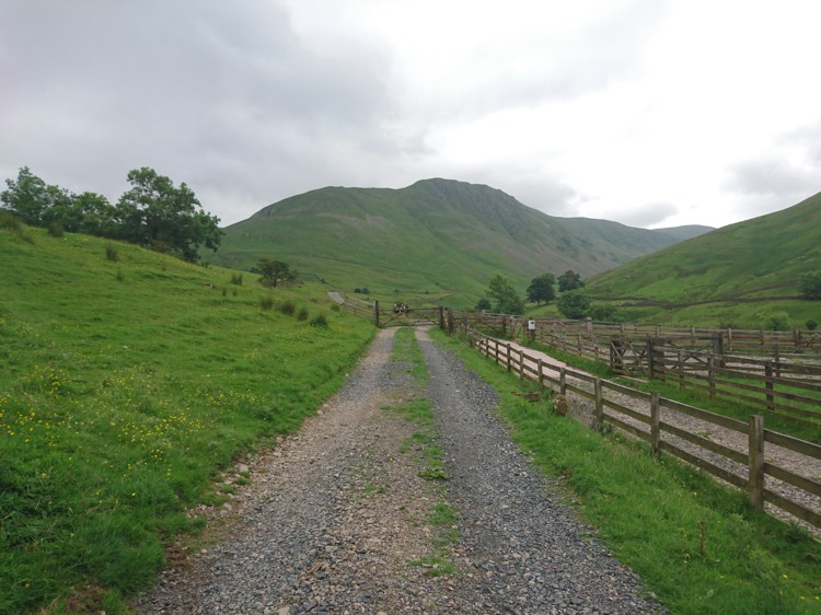
The Start Of The Walk

The Car Park and Gate
The walk begins at the car park in Hartsop. To get to the car park, take the A592 that runs between Glenridding and the Kirkstone Pass. If you are coming from the Ullswater / Glenridding direction, the turning for Hartsop is on the left hand side approximately 2-miles beyond the village of Patterdale.
If you are coming from the Kirkstone Pass the turning is on the right just after Brother’s Water, a small lake on the left hand side of the road. Go through the village of Hartsop, following a very narrow road. Continue right until the end of the road, where it becomes a gravel track that opens out into a parking area. There is a gate on the other side that marks the beginning of the walk.
The Sheep Pens
The Gate by the Sheep Pens
Go through the gate in the car park. There is a signpost marking the public bridleway and an information board about the hydroelectric station. Follow the path and on the right hand side there are fenced off sheep pens. Just beyond these pens is another gate that you will need to go through, carefully closing it behind you.
The Cattle Grid
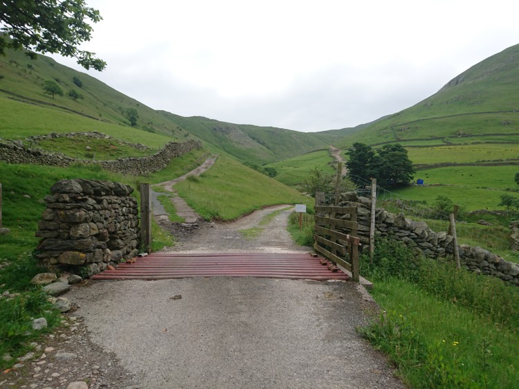
The Cattle Grid
Continue on the route, passing two turnings on your right, the first being a fairly substantial track leading back down through the farmland, and the second being a small grassy track that leads down to an abandoned mine. You will then come to a cattle grid, and just beyond there is a fork in the path. Go over the cattle grid (you can also go around it on the left) and take the right hand fork.
The Bridge
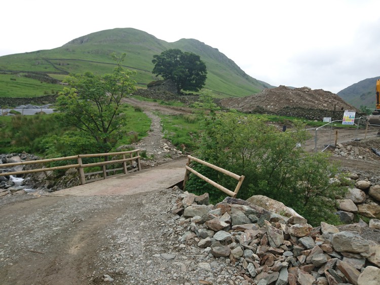
Temporary Bridge and Works
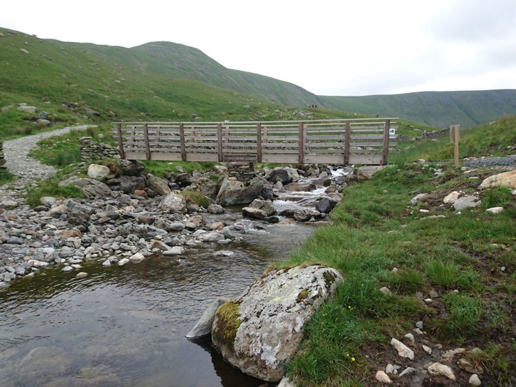
Pass another turning on the right-hand side, and you will then come to a bridge. At the time of writing, the bridge was replaced with a temporary structure with building works for the hydro-electric station. This is anticipated to be completed by the summer of 2016. Go over the bridge and the path veers to the left, and inclines fairly steeply. You will pass through another couple of gates before the path begins to level out again.
Following The Gill – Alternative Route For Return
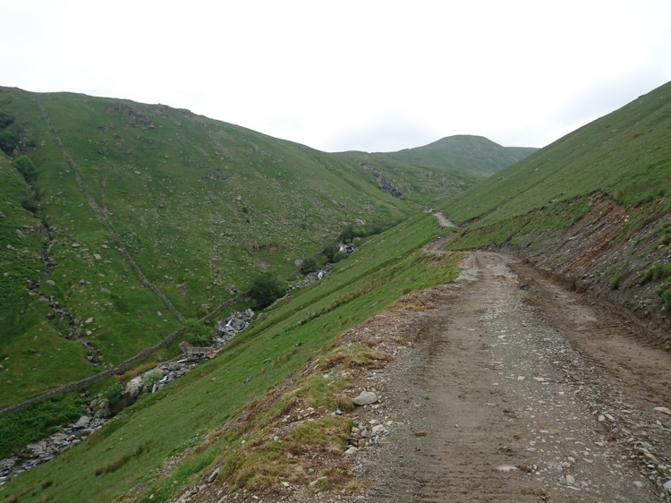
Hayeswater Gill
After a fairly steep section of path, the route levels out and the waterfalls of Hayeswater Gill come into view on the left hand side. As you look down over the gill, you will be able to see the old filter house on the other side. Just beyond the filter house there is a footbridge crossing over the gill, leading onto a path that rises steeply up the fell side to join the track you are on.
If you prefer, you can take this route back on your return, following the path past the filter house, and it will lead you back to the cattle grid. However, this route is not suitable for all terrain pushchairs and young children may struggle with the initial climb down to the footbridge.
Footpath To High Street
The Footbridge to the High Street
You will come to a turning on the left with a narrow footbridge. The path from the footbridge leads up to High Street, an old Roman road and fell that offers spectacular views of the eastern Lake District. The bridge provides a lovely opportunity for young children to take a rest, throw some stones, or play a game of pooh sticks. To continue up to Hayeswater, do not cross the bridge and stay on the track.
Arriving at Hayeswater

Hayeswater
Go past the bridge and after approximately 200-metres Hayeswater will be visible. Hayeswater Gill flows freely from where the dam once stood, with water shallow enough in places for paddling. There are plenty of grassy spots and large boulders for picnics, and small tracks lead along either side of the tarn waiting to be explored. The route ends here, and the way back is the same way you came up.