Orrest Head and Lake Windermere
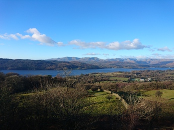
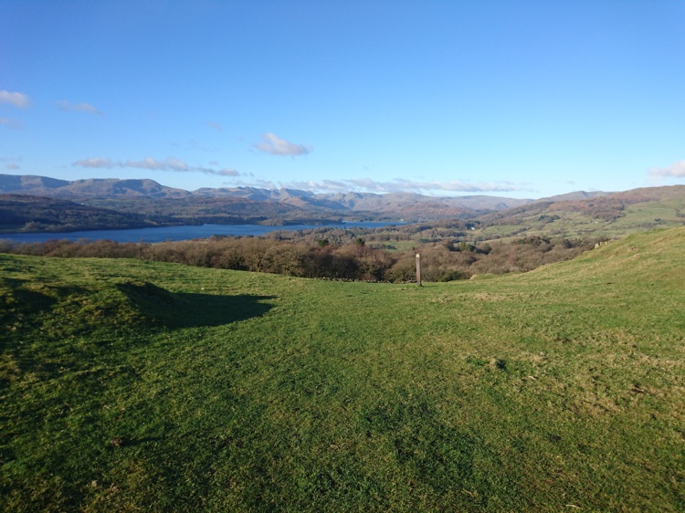
View of Lake Windermere from the Summit
Writing about his ascent of Orrest Head during his first trip to the Lake District, fell walker and guidebook author, Alfred Wainwright, wrote “It was a moment of magic, a revelation so unexpected that I stood transfixed, unable to believe my eyes.” So inspired was Wainwright by the view that he would eventually leave his native Lancashire and set up home in Cumbria in order to spend his life wandering the fells. This route includes both Orrest Head and the shore of Lake Windermere, with the option to have lunch in Windermere in between.
Whilst some of the walk is on a fairly even path, a significant portion of it is not suitable for all-terrain pushchairs, so you will need to use a carrier here instead. Very young children may struggle with the distance, but the break in the middle in Windermere should help with this.
Quick Facts
Distance: 3.5 miles
Time: 3 hours
Terrain: Mixture of level paths, grassland, and rocky steps
Suitable For: Older Children, Younger Children with Assistance, Babies and Toddlers in Carriers
Parking: Pay and Display parking at Rayrigg Meadow & Millerground. Post code LA23 1BP, Grid Ref SD 403 985
Facilities: Toilet block at Rayrigg car park (20p charge); Additional facilities include cafés, restaurants and shops in Windermere
The Start of the Walk
Rayrigg Car Park
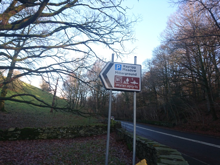
To get to the car park, take the A592 between Windermere and Bowness-On-Windermere that runs close to the shore of Lake Windermere. The car park is on the left if you are coming from Bowness and on the right if you are coming from Windermere, and is clearly signposted. Once you have parked, walk back out of the car park onto the A592 and cross over the road, then head left, towards Windermere. There is a wide pavement either side of the road.
The Path to St Mary’s Church
The Start of the Path to St Mary’s Church
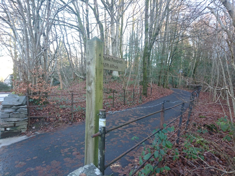
After a short distance alongside the A592 you will see a turning for a wide tarmacked path on the right, signposted for “A591”. Take this path. It will lead you alongside some woodland initially, and then past some houses, before ending at the A591. Turn right at the end of the path and St Mary’s Church will be just ahead of you on the left.
The Path to Orrest Head (Alternative Start Point)
Orrest Head Sign
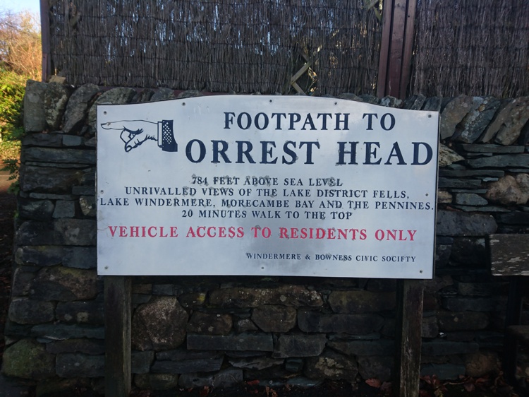
Go past St Mary’s Church, and at the junction, cross over the road to continue straight on. You will pass Windermere Preparatory School on the opposite side of the road. Just beyond the school there is a layby that offers an alternative parking place, should you wish to skip the lake shore section of this route. However, there are time limits in force here. Cross the road at the pedestrian crossing and on the left-hand side a green metal fence marks the start of the Orrest Head path. The entrance is at the other end of the fence, and there is a large sign pointing the way.
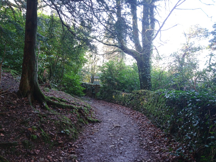
Following the Green Arrows
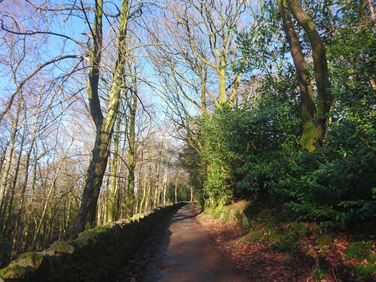
The Path through the Woodland
The path starts as a tarmacked track. There are a few houses up here so you may meet the odd car. After a short distance you will come to a fork in the path, with the left fork signposted for Troutbeck Road. Take the right fork here. Continue along the track, past the small Ironworks where the track becomes a more uneven path through woodland. You will come to another fork in the path, with green arrows indicating that you can take either route. The left route is longer but more level. The right route is steeper but shorter.
Continue heading up the path that becomes increasingly uneven. At the three wooden benches, veer right, then follow the green arrow going straight up the hill. You will see a short wall in front of you at the top that you need to head toward.
The Heywood Memorial Stones
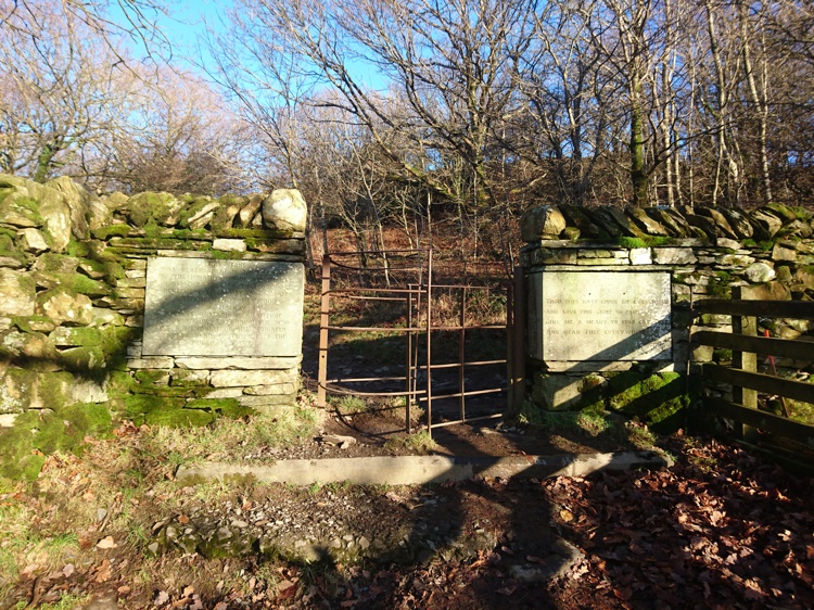
Memorial Stones and Gate
At the top of the hill go around the end of the short wall and turn right, leading you onto a path with a wall on your left and a fence on your right. At the end of this path, you will reach a kissing gate with a memorial to Arthur Heywood. Heywood originally owned the land that Orrest Head is on and it was donated to the people of Windermere following his death. Go through the gate.
Orrest Head Summit

View of Lake Windermere from the Summit
Beyond the gate there is a set of stone steps leading up to the summit. Be aware that towards the top it can be slippery in places. At the very top there is an information plaque that details the fells that are visible. The plaque is dedicated to the memory of Alfred Wainwright and was created in his distinctive style. The panoramic view includes Scafell Pike, Old Man of Coniston, and the Langdale Pikes.
The Descent from the Summit
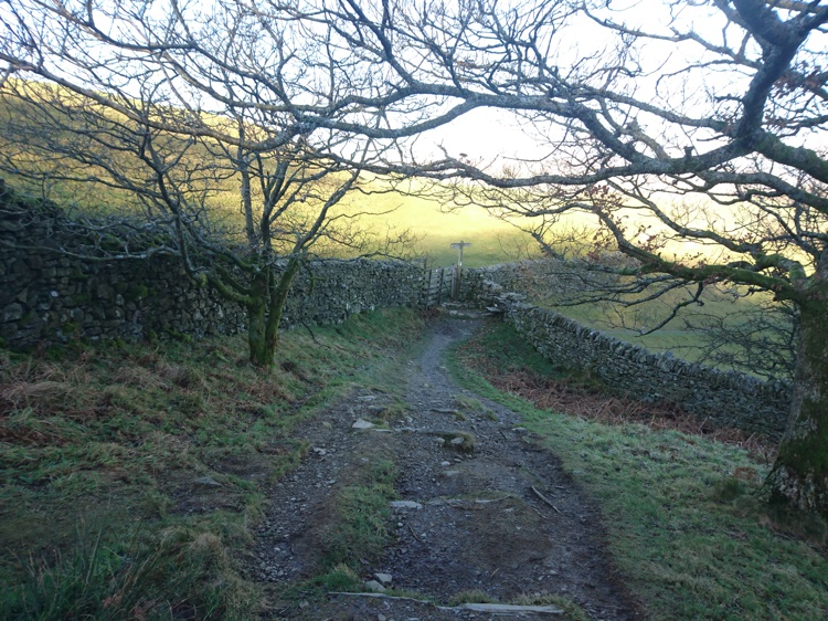
The Gate with Two Walls
The quickest way back is to simply retrace your steps. However, if you want to make the walk longer, look for a stone bench at the opposite end of the summit to where you arrived. Beyond the stone bench there are two paths leading off the summit. Take the one on the left. This is a wide grassy path with a boundary wall on the left. At the bottom of the path, the wall meets the wall running along the bottom of the field, and in the corner there is a gate for you to pass through.
Through the Field
Post Marking the Way in the Field
Be aware of any grazing livestock at this point and be sure to keep dogs on leads. You will now be in an open field, and the path is not obvious, but for a couple of posts marking the way. Head straight in the direction of the posts, with Lake Windermere stretched out in front of you. You will then come to another wall with a stile over it (as of January 2017 the wall had a large hole in it with no need for the stile). If you prefer, for an even longer walk, you can go over the stile and take one of a number of routes through St Catherine’s Wood back to Windermere. However, for this route, instead of going over the stile turn left, keeping the boundary wall on your right.
Returning to the Woodland

The Field Boundary Wall
Keeping the boundary wall on your right, you will walk through the field until you reach the edge, with the tall trees of the woodland clearly visible on the other side. Here there is a gate, but it is kept locked and instead you must cross the wall using the stone steps either side. These can be tricky to navigate so do take care here. On the other side of the wall turn right to join the woodland track.
Return to Windermere
The Woodland Track
Follow the track, and where it splits, take the lower, right-hand fork, keeping the boundary wall on your right. You will come to a junction with a signpost, and turn left here, signposted for Windermere Village. This will lead you back onto the A591 that you left at point three of the route. Cross back over the pedestrian crossing and turn right. Turning left onto Elleray Road will lead you into the village centre where you will find a number of options for refreshments. Alternatively, continue straight on and retrace your steps back to the car park.
Queen Adelaide’s Hill
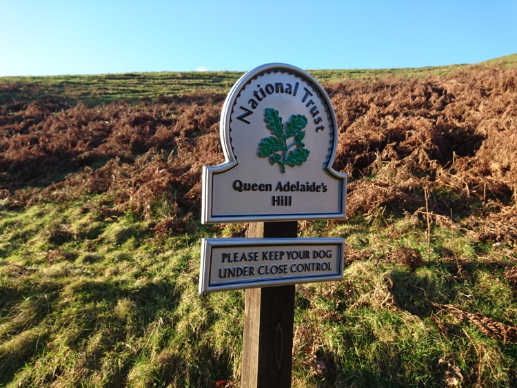
Sign Marking Queen Adelaide’s Hill
Once you have returned to the car park, you can visit the lake shore. At the opposite end of the car park to the entrance there is a gate and a National Trust sign for Queen Adelaide’s Hill. Go through the gate and follow the path up the hill. Despite being quite short and easy to ascend, the view of Lake Windermere from the top is very rewarding. At the top, head down the other side toward the boat houses, where you will see a path leading along the wall. Turn left at the path.
The Final Stage – The Lake Shore
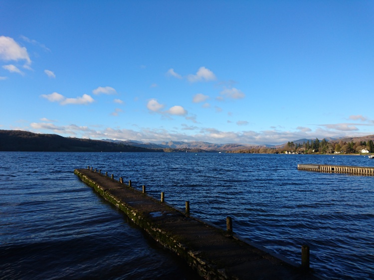
Jetty on Lake Windermere
Go through the large gate and this will bring you to the shore, with the path continuing alongside it. Follow the path until you get to an information board and seating area. Turn left here, leading away from the shore. The path will bring you directly back to the car park.