Harrop Tarn (Thirlmere)

Picturesque Views of Thirlmere
With over 16 million people visiting the Lake District each year, finding moments of solitude in the national park can be difficult, but if you know where to look, those moments of peace are achievable. This walk takes you to Thirlmere – a lake that is often overlooked in favour of its more accessible and tourist friendly lakes. The walk winds steeply through woodland up to the rarely visited Harrop Tarn, passing a magnificent and loud waterfall along the way.
This glacial tarn may not have the picture perfect appeal of Tarn Hows or the magnificent views of Angle Tarn, but it does offer a place for quiet contemplation. Best of all, with no livestock, and a path that is fairly easy to navigate, this walk is excellent for families and dogs.
Quick Facts
Distance: 3 Miles
Time: 1-2 hours
Terrain: Stepped woodland path, gravel track
Suitable For: Dogs, Children 5+, Babies and Toddlers in Carriers
Parking: Pay and display parking at United Utilities Dobgill Bridge NY 316 140
Facilities: A small toilet block is located in the car park; The Kings Head Inn by Thirlspot is a short drive from the car park
The Start of the Walk
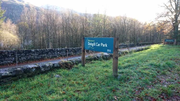
The Car Park Entrance
Dobgill Bridge Car Park is located on the small minor road that runs along the western side of the lake. This road is accessed from the A591 between Keswick and Grasmere, and is signposted as “Public Road Around Lake”. There are a number of car parks along this road owned and operated by United Utilities who are responsible for the reservoir. The Dobgill car park is closer to the southern end of the lake and is clearly signposted. Once you have parked, as you stand with your back to the lake there is a path with a signposted for Harrop Tarn at the back of the car park on your left hand side. This is the path you need to take.
The Stone Wall and Rock Face

The Stone Wall with Rock Face Behind
Go through the gate that is directly ahead of you and you will now find yourself on a stepped path that winds up the hill through the woodland. The path is fairly easy to follow, but do take care in the wet as the rocks used to form the path can be slippery. You will see an old stone wall ahead, with a spooky looking rock face that seems to have sprung out of the ground behind it. Children may enjoy exploring this rock, which could be seen to resemble an ancient castle or fort. The path will take you up to the end of the wall, and here you will need to turn right to continue along the path.
Up to Dobgill Falls
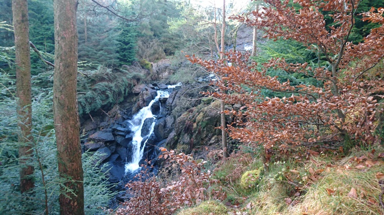
Dobgill Falls
The path leads around the right of the rock face and up behind it, becoming increasingly uneven and somewhat steeper. At the top, the path levels out, and you will start to hear the roar of Dobgill Waterfall. A way marker helpfully points you along the path, and after you have turned a corner you will find yourself walking alongside the top of the waterfall. If you have young children do take care here, as there is quite a significant drop at the edge.
The New Woodland
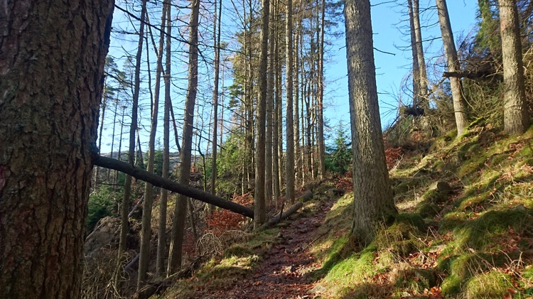
Fallen Trees
Continue along the path. At the top of the waterfall, much of the damage from Storm Desmond in 2015 is still apparent with displaced boulders and fallen trees all visible around the water. It’s worth noting that in November 2017 when this guide was produced, the path was blocked by a couple of fallen trees. These were easily passable either by climbing over or crouching under, but any toddlers in back carriers would need to be removed. Beyond the waterfall the path levels out, and you will find yourself walking through a much younger patch of woodland.
The Top of Dobgill

The Footbridge
The trees clear and you will see the waters of Harrop Tarn and Dobgill ahead of you. The path drops down to be level with the water, and if you turn left, there is a delightful footbridge, accompanied by stepping stones, across the top of Dobgill. It is possible to cross this bridge and take the path down the other side of Dobgill, though this path is trickier to navigate. The bridge makes an excellent point for throwing stones for children, and from here the Helvellyn range is visible across Thirlmere.
Harrop Tarn
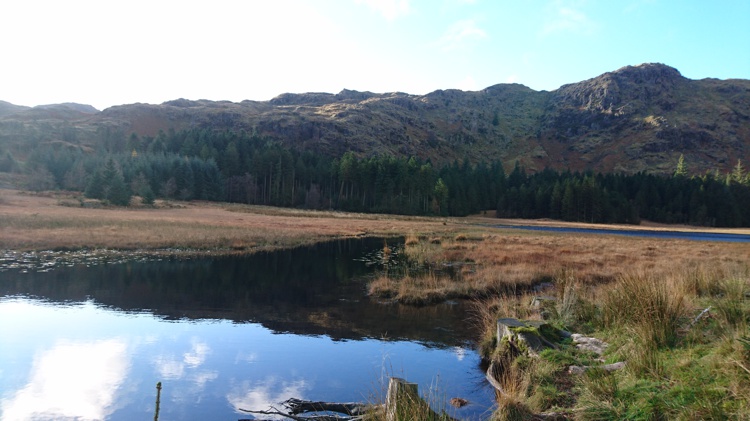
Dobgill Leading into Harrop Tarn
Turn away from the footbridge and head back towards where you came from, but instead of taking the path back up through the woodland, take the Forestry Commission track instead that runs alongside the tarn. Most of the tarn is obscured by the trees, but at the point where Dobgill meets the tarn, there is a great picnic and paddling spot.
The Forest Track

Thirlmere from the Track
Follow the Forestry Commission track. This leads you through more woodland, away from the tarn, and ascends slightly before it begins to descend down towards the lake. You will cross a stream, and go through a gate, and eventually the lake comes into view. Go through a second gate, and pass a turning on your left.
Return to the Car Park
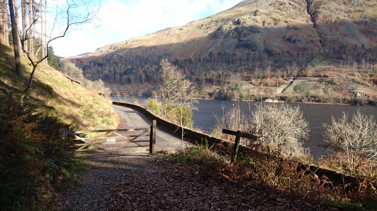
The End of the Track
The track leads down to the lake road with a final gate for you to go through. Turn right on the road, and walk the short distance back to the car park. If you wish, there are a couple of gates on the left that enable you to access the lake shore for further exploration