Scale Hill and Crummock Water Loop

Lanthwaite Woods
Crummock Water is often overlooked in favour of its smaller neighbour, Buttermere, partly because it is further away from the facilities available in the village of Buttermere, and partly because it is a much larger lake, making parts of its shore inaccessible to beginner walkers. Consequently, this walk from Scale Hill to the northern shore of Crummock water is popular with local families seeking a quieter place to walk away from the crowds of visiting tourists.
All-terrain pushchair users will be able to do most of this walk with ease, however, there are three very narrow bridges to cross that will require you to remove your baby and carry the collapsed pushchair across. These bridges are located after you have reached the lake, so you could decide to simply turn back the way you came after a picnic on the shore, an option that may also suit very young children due to the shorter distance this involves.
Quick Facts
Distance: 2 miles (or 1 mile if turning back at the lake shore)
Time: 1-2 hours with young children
Terrain: Level, well-maintained paths throughout. No stiles, but there are three very narrow footbridges with steps to cross.
Suitable For: Older Children, Younger Children with Assistance, Babies and Toddlers in Carriers, All-Terrain Pushchairs with Two People
Parking: Pay and display parking at the National Trust Scale Hill car park. Grid ref NY 149 215. National Trust members can park for free with a valid parking pass.
Facilities: None on the route. Both the Kirkstile Inn in Loweswater and the Wheatsheaf Inn in Lorton both do excellent pub food.
The Start Of The Walk

The Gate out of the Car Park
The National Trust car park at Scale Hill lies on the narrow road that runs between the villages of Lorton and Loweswater, and is best accessed by the B5289 that runs from Cockermouth to Lorton. If you are approaching from Lorton, the car park is on the left hand side, after you have passed the Scale Hill Self Catered Accommodation, and just before you cross over a stone bridge. The turning is easy to miss. At the opposite end of the car park to the entrance, there is a gate that marks the start of the walk.
Fork in the Road
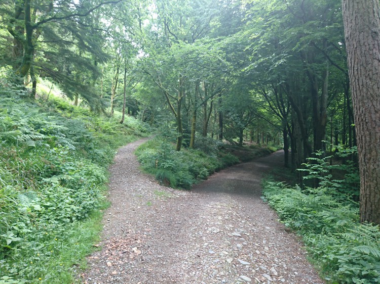
Fork in the Road
Go through the gate into Lanthwaite Woods. After a short distance you will reach a fork in the road. Take the right hand fork to continue down to the lake.
Exploring the Woods
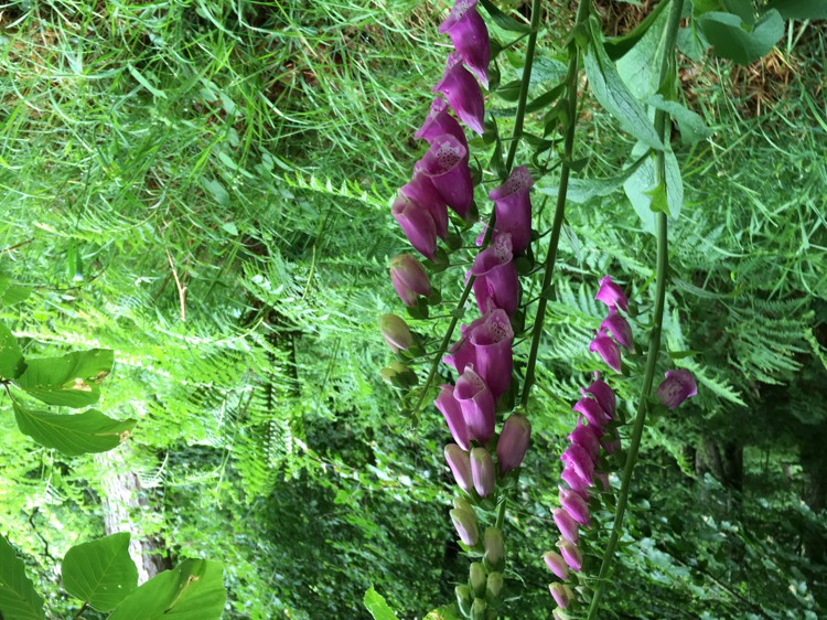
Foxgloves
As you continue on the route, exploring the woodland around you will reveal hidden caves, dens built by past walkers, a babbling brook, and numerous plants. Foxgloves grow in these woods and are poisonous, so children and animals should be supervised. You will pass another turning on the left that leads back up the hill, and you will then come to a second fork in the road. Again, take the right hand turn.
Arriving at Crummock Water
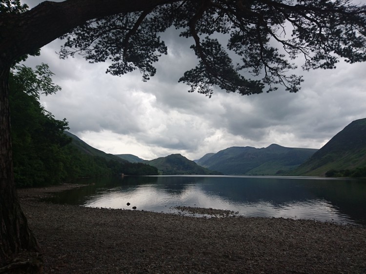
The Lake Shore
After the second fork in the path, you will come to the shore of Crummock Water. There is a bench here and a number of boulders that make for great picnic spots, as well as plenty of stones for skimming. If you do not want to carry your pushchair over the three narrow bridges, or want to cut your walk short to accommodate very young children, you can turn back the way you came at this point.
Narrow Bridges
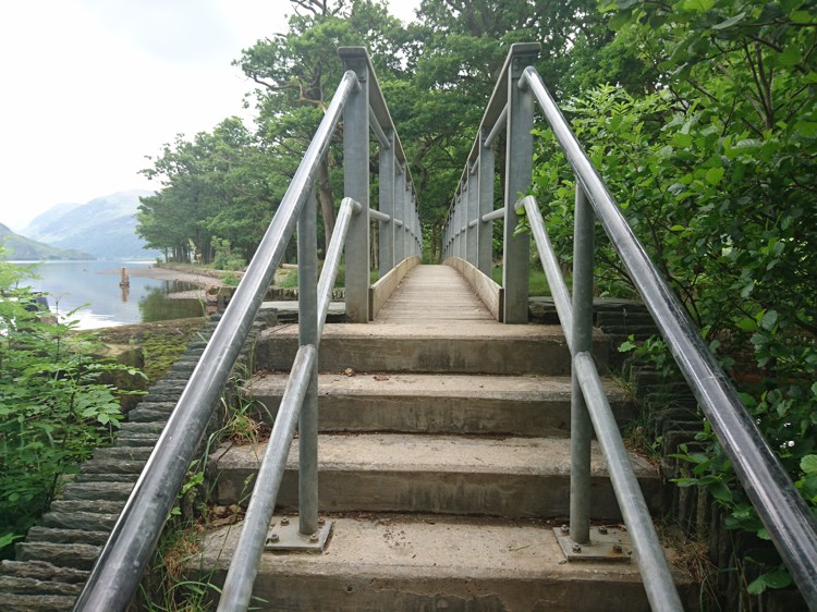
Narrow Bridge
As you face the lake, a path leads off to your right. This will take you past the weir and to the first of two narrow bridges, both with steps leading on and off them. These bridges are too narrow for all-terrain pushchairs. Depending on the type of pushchair you have, it may be possible to remove your back wheels, reducing the width of the pushchair, and carrying it over with one person at the front and one person at the back. Just beyond the first bridge, there is a second one that you will also need to cross.
The Path to the Pump House

The Pump House
After you have crossed the second narrow bridge, the path leads along the shore of Crummock Water. A number of trees have been felled in this area and the trunks have been carved into benches, making this another excellent picnic spot. You will come to a third bridge, and again this is too narrow for all-terrain pushchairs. Cross this bridge and continue along the path and the pump house will eventually come into view.
The Farm Track

The Gate and Bridge
As you approach the pump house, you will see a gate to the right of the building. Go through this gate and instead of going back towards the lakeshore, veer right, following a grassy track. You will be able to see a bridge and a gate in the distance and you should aim for this bridge. Cross this bridge (wide enough for pushchairs), and go through the gate at the other side.
Following the Farm Track

The Last Gate
After crossing the bridge and going through the gate you will find yourself on a farm track with meadows either side. Continue along this track, passing through a series of gates, taking care to shut each one behind you as you go. The final gate will bring you out onto a quiet lane that is rarely used, next to Muncaster House. Go through this last gate and turn right onto the lane. After a couple of hundred metres you will then come to a crossroads. Turn right again, leading onto the stone bridge, and the Scale Hill car park is just the other side on the right.